Beacon Rock was a 1-mile hike to a summit at 850 feet (approximately 850 feet elevation gain – it is right on the Columbia River). The next day, I hiked to the top of Sleeping Beauty peak, a 1.2-mile hike to 4,900 feet elevation (1,400 feet elevation gain). The abandoned lookout at the top provided amazing views of Mt. Hood, Mt. St. Helens, Mt. Adams, and Mt. Rainier (before the clouds covered it up). We could hear a thunderstorm brewing on Mt. St. Helens and it was clearly raining on the South Butte of Mt. Adams, where a group of us would be hiking the next day.

View of Adams from Sleeping Beauty Peak
The next day after hours of being in the sun and walking around, 11 of us started up the South Spur trail of Mt. Adams at 6 pm. (All along I had thought we were starting this hike on Saturday morning…) This left us with 3600 feet to our goal; “the Lunch Counter,” and less than 4 hours of daylight to get there. Another thing that made this trip difficult for me was the snow conditions. I was prepared (or thought I was) for the idea of having to hiking a snowfield up to the false summit (so, starting at 9000 feet). But it turned out there was up to 2 feet of snow starting at 6500 feet.

Early on, on the trail.
I was extremely thankful for loaned ski poles and yak traks but after 2000 feet of snow hiking, I knew I wasn’t properly equipped for another 4000 feet of it. So, I decided to stay at base AmeriCamp at 8300 feet the next day while most of the other people got up at 4 am to hike to the summit. It turned out I was perfectly content to sleep in until 8 am and wake up with a panoramic view of Mt. Hood and Mt. St. Helens and the Gifford Pinchot National Forest 3000 feet below.

Getting dark on the first night

Sunset from 8300 feet with Mt. St. Helens to the East

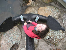
Marley and Mt. Hood to the South the next morning
In my 3000 feet of hiking, there was one snowfield that was particularly adventurous to traverse. On the way up, we had to kick-step-pause up a 100 foot “snow ladder” a la the Klondike Gold Rush ladder. And, on the way down, the “safest” way to get down this snowfield was by glissading the 300-foot drop from farther up the snowfield. At the time, I was, well… scared, but looking back it was fun and other than several scraped knuckles, I came out unscathed.

View from the top of the snowfield

View from the bottom of the snowfield. Marley and the glissade chute in the background.

No comments:
Post a Comment