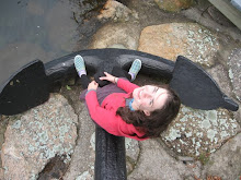
Last week I hiked two completely different hikes to the tops of two completely different waterfalls. First I hiked to the top of Golden Falls in Golden and Silver Falls State Park west of Coos Bay. It was a 1-mile hike to the top of a 100-foot waterfall, not bad, not bad…
But then I stopped at Multnomah Falls in the Columbia River Gorge on my way to an AmeriCorps training. Now if I had known I was going to do the whole 1.2-mile hike to the top of the falls, I may have strapped on my hiking boots. And if I had known Multnomah Falls is actually the second tallest year round waterfall in the nation, I may have abandoned the idea completely. But I didn’t know either of those things at the time. I started up the 0.2-mile hike to the bridge over the lower 69-foot falls, and I just kept going. Besides wanting to move past the cold shower I was receiving on the 45-foot bridge, I had an overwhelming sense that there was a reason to get to the top of this waterfall, a reason to not give up, if only just to know that I had done it.
Well, it turns out Multnomah Falls is 620 feet in height total and a 1.2-mile trail to get there makes that an almost 10% grade. On the other hand, the 1-mile hike I had done earlier that week amounted to a less than 2% grade. No wonder my legs hurt so much more after the second hike.
After the Multnomah Falls hike, I could have really gone for a big cone of ice cream. And if it had been 1919-1924, I could have had just that at the bottom of the falls at “Multnomah Hazelwood” which was a drive-in version of a popular Portland ice cream parlor at the time. Now, there is something to start looking for an antique, linen postcard of.
--------------------------------------------------
View from the top of Golden Falls.
 View from the bottom of Multnomah Falls
View from the top of Multnomah Falls

 You can view the full size press release
  t week I was exploring what seemed like 24-7 with one of my favorite humans. We drove the Oregon Coast from Lincoln City to Port Orford stopping at every state park and “wayside” that intrigued us. It felt like we hiked as many miles as we drove. Each coastal alcove is a completely different ecosystem. Cape Arago State Park is very similar to Port Orford Head (see picture) with its steep vegetated cliffs with boulders on the beach. But in between; Face Rock and Devil’s Kitchen State Parks are long flat beaches of fine sand with rare basalt outcrops and islands.

